![]()
![]()
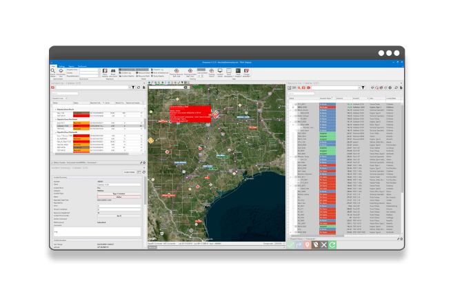
Fire Incident Operations
Enterprise incident management, dispatching and resource tracking system available on an integrated desktop, web and mobile platform.
fiResponse® represents the collective experience and needs of emergency managers from numerous agencies, embedded inside the most robust GIS and DBMS platforms for implementing mission critical applications available from Esri and Microsoft.
![]()
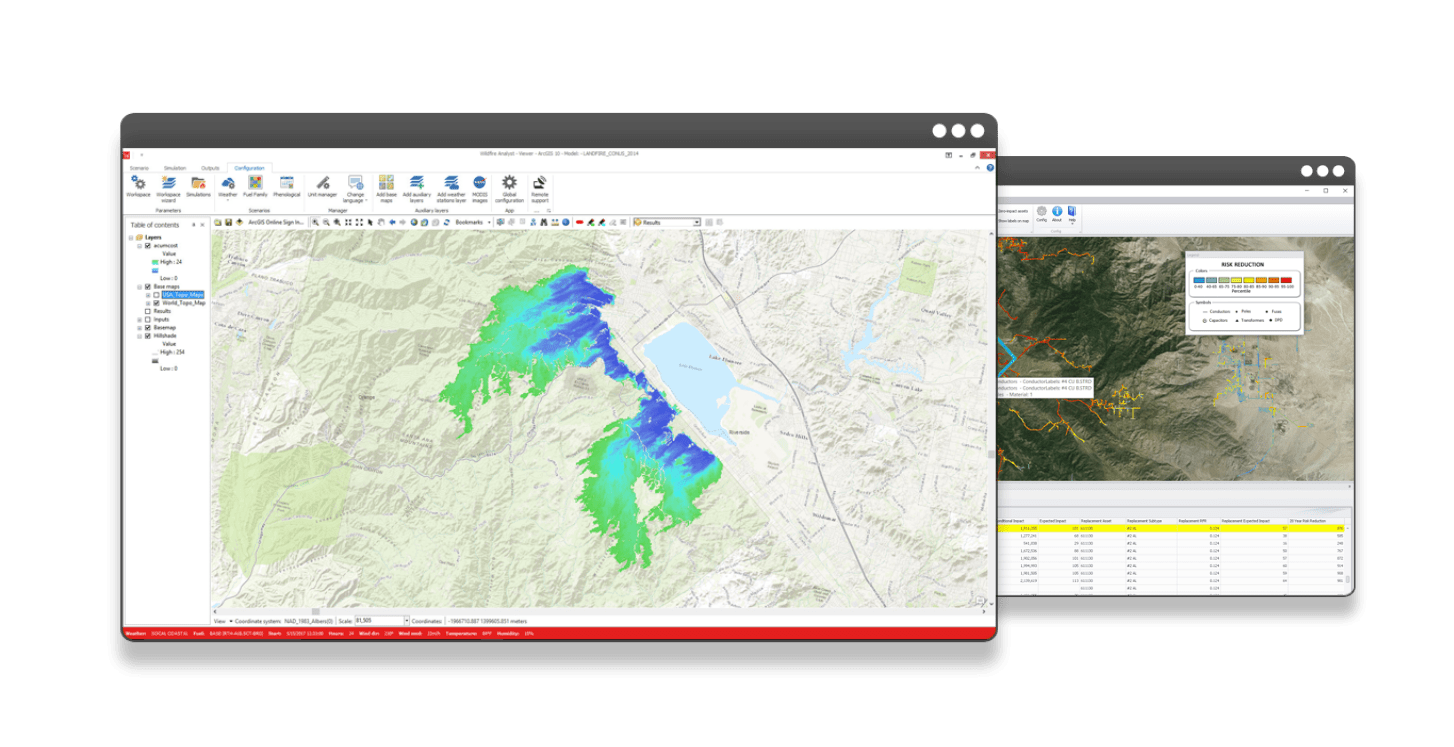
Wildfire Behavior Analysis
Wildfire Analyst® is the advanced state-of-the-art wildfire behavior and spread simulation for both desktop and web services, delivering real-time modeling capabilities to your fingertips in minutes.
The software integrates real-time weather acquisition with advanced modeling to calculate where a fire is going, when it going to reach critical locations, and what potential impacts there may be.
![]()
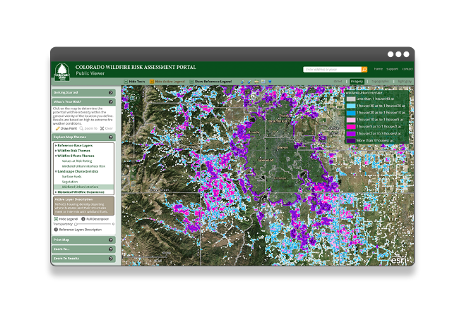
Fire Protection Planning
As a leading provider of wildfire risk assessment services in the Nation, we are driven to develop the best solutions for putting the information to use.
Working closely with state agencies, we have developed a customizable interactive web mapping application that provides tools for planners, decision makers, and the public, to utilize risk assessment outputs immediately.
![]()
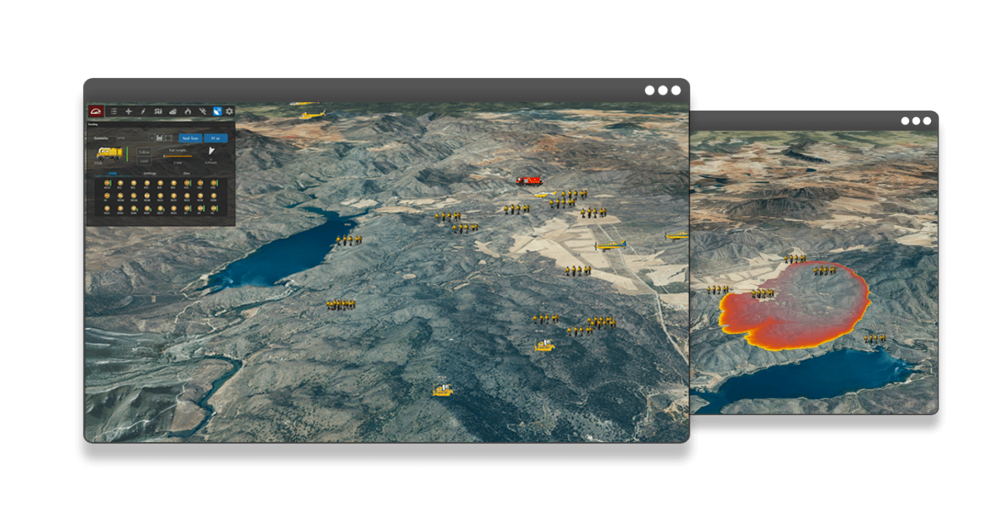
Real Time Operations
Tracking resources in real time. Ground units and Aircraft. Crews and Engines. Dozers and Trucks. Everything integrated into a real-time fully operational 4D GIS environment, based on latest Esri technology.
Control time enabled events and GIS datasets. Integrate Weather predictions, Aerial and Satellite Imagery, from public sources or from within your organization.