 

Advanced Solutions For Wildland Fire


Emergencies and public safety, emergency planning and risk prevention


Land and urban planning, forestry planning and natural resources management


Use of geotechnologies and advanced analysis using satellite remote sensing and LiDAR to provide solutions in the land engineering


Modeling of high precision forest fuels: dynamism of critical points and simulation of fire behavior

1
1

Tecnosylva provides advanced GIS-enabled software solutions for wildfire protection planning, operational response & firefighter and public safety.

Our solutions encapsulate years of forestry and wildfire experience into efficient, timely and responsive applications.

We complement our software products with seasoned consulting services for wildfire analysis & modeling, fuels mapping, wildfire risk assessment, and custom web & mobile applications development

ENGINEERING

Like what you see? Have a look at the services we offer with every project.

OUR SERVICES

 Find out more about who we are and what we have to offer our clients.

ABOUT US

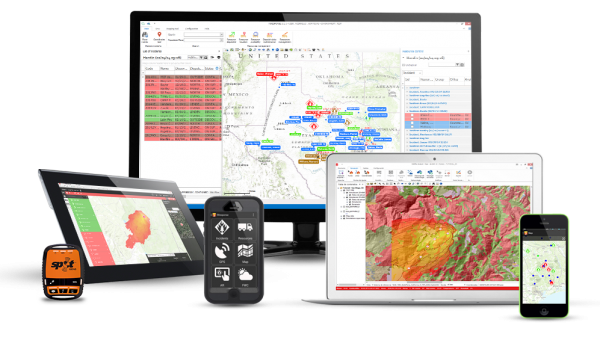
Find out about our industry leading fiResponse™ & Wildfire Analyst™products.

KEY PRODUCTS

Technosylva collaborates with: