![]()
At Tecnosylva we love to solve problems and craft solutions. With this aim we provide a wide range of consultancy services: Land Engineering consultancy services, Wild land fires, Geo-technologies and software developments. Our professional services as well as our participation in international R&D projects are at the heart of our industry leading software products. We are able to leverage our subject matter knowledge, technology expertise, and extensive partnerships to offer a suite of services.
EMPOWERING OUR CLIENTS
THE RIGHT TOOLS FOR THE JOB
Our services not only solve problems for our clients, they empower them with the key information and tools necessary to make difficult decisions in their day-to-day activities.
Training
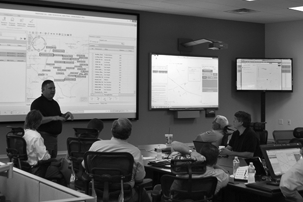
At Tecnosylva we are aware that our clients can only benefit from our services and solutions in their daily tasks if they know how to use them efficiently, by knowing all the features, processes and knowledge behind them. Therefore, we offer a wide range of training services for both, learning specific scientific subjects as well as the training of our end-users in the use and management of technological solutions.
Relevant Information
We are experts in fusing our consultancy services in Land Engineering, Wildfire and Geotechnologies with GIS based solutions – weather for Land Use management, forestry management, environment consultancy, fire behaviour analysis, emergency management or the creation of thematic cartography.
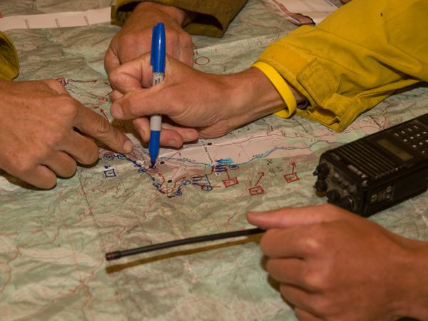
Our main aim is to provide solutions that allow the professionals taking faster and more efficient decisions – being it through desktop, web or directly on the field with the use of mobile devices. It is all about empowering people with the information they need to take decisions in a timely manner.
In collaboration with key international agencies, our technical team has designed, developed and implemented an impressing software solutions suite that create awareness, train and provide the professionals with the key information to manage their daily tasks and take critical decisions. Solutions such as:
This web application shows the way we support our clients through the implementation of interactive visualisation and interactive mapping apps, that enhance the analysis of the information for different user profiles and purposes.
PRACTICAL APPLICATION OF THE INFORMATION
GIS BASED SOFTWARE
We are specialists in integrating forestry and forest fire management in GIS software solutions – whether for prevention plans, risk assessment, urban forestry or the real-time analysis of the fire.
We provide solutions to the land management professionals for taking faster and more effective solutions – whether through a desktop application, web app or directly on the terrain through a mobile devices.
It’s all about enabling people with the information necessary to make decisions in a timely manner.
Our team designed, developed and implemented an impressive suite of software in collaboration with key forest fire management agencies worldwide. These software applications create awareness, educate, and enable planners, managers and responders with key information about their jurisdictions and ownerships.
Take a look at some example projects we haved worked on with this key agencies.
VIEW PROJECTS
MAKING A DIFFERENCE
LEADING THE WAY
At Technosylva, our vision is clear – to provide services for land management, Forest fires management, Geotechnologies as well as the development of technological solutions that allow our clients to make the difference. We realise the importance of what our clients do, and how critical getting timely and accurate information is. After all, it can save lives, homes and properties.